Flooding and mudslides have been common in the Southwest since Tropical Storm Kay brought an increase in moisture to the region last week. AccuWeather forecasters say more drenching rain is on the way.
AccuWeather Global Weather Center – September 14, 2022 – After days of scorching, record-shattering heat in the western United States, cooler air has filtered in along with daily showers and thunderstorms across the region. AccuWeather forecasters say that more of the same is expected through the rest of this week, even as the exact location of these storms may shift around from day to day.

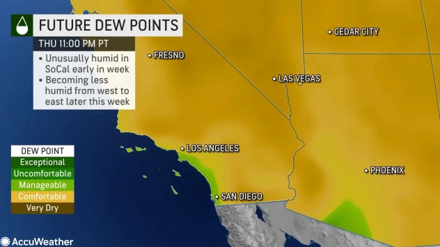
This stretch of wet weather began late last week, with rain from Tropical Storm Kay dousing much of Southern California, and leading to issues with flooding and mudslides. Meanwhile, a surge of tropical moisture associated with the North American monsoon overspread much of the Intermountain West, bringing daily showers and thunderstorms across the region.

Not every location across the West has had storms on a given day, but storms that have formed have often been intense, bringing heavy rainfall and strong wind gusts to some locations.
In Phoenix, storms arrived late Sunday evening. Along with a quick 0.62 of an inch of rain in the city, damaging wind gusts reached as high as 86 mph at Sky Harbor International Airport, one of the busiest airports in the country, prompting a ground stop that caused flights to be delayed and rerouted.
Las Vegas set a daily rainfall record on Monday when a total of 0.17 of an inch fell. The previous daily rainfall record for Sept. 12 there was 0.05 of an inch, which was set back in 1969.

Leave a Reply