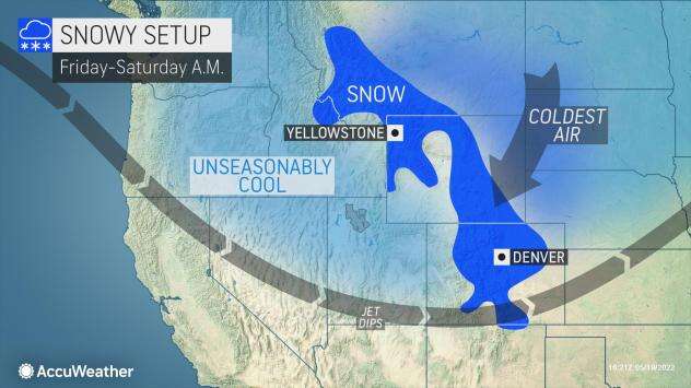
AccuWeather meteorologists expect a general 3-6 inches of slushy snow to accumulate on non-paved surfaces around downtown Denver, while the foothills to the west and the Palmer Divide to the south could pick up a foot or more on non-paved surfaces from Friday night to early Saturday.
AccuWeather Global Weather Center – May 20, 2022 – The calendar may read mid-May but parts of Colorado, including the Denver metro area, are bracing for a storm that would make winter proud. AccuWeather forecasters say the 93-degree AccuWeather RealFeel® Temperature that roasted the Mile High City on Thursday will be a distant memory by Friday and into the early part of the weekend.

Winter storm watches and warnings were in effect across a large section of Colorado and northward into Wyoming, and for good reason. AccuWeather meteorologists are calling for 3-6 inches of accumulation in downtown Denver and some places on the southern and western side of the Denver metro area could see as much as a foot of snow pile up, enough to potentially result in widespread power outages.

Red flag warnings were in place for much of eastern Colorado on Thursday — a sign of how changeable the spring weather can be in Colorado at this time of year.

A rush of cold air will bring an end to temperatures in the 70- to 90-degree range, and it will also allow rain to transition into accumulating snow from Montana to Colorado as a storm arrives from the Northwest. In some locations, snowfall totals could even surpass a foot.

Denver will plummet at least 50 degrees from high of 88 Thursday to the mid-30s Friday morning. In fact, the temperature fell by 21 degrees in just 7 minutes between 7:37 p.m. and 7:44 p.m. MDT on Thursday evening when the cold front moved through Denver. Temperatures may struggle to rise more than a few degrees Friday before dipping to the upper 20s Friday night with snow in the forecast. The old record low of 31 that was set in 2019 is poised to fall.

Leave a Reply