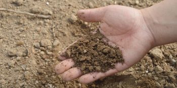
DENVER, CO — USDA’s Natural Resources Conservation Service (NRCS) is conducting a field inventory of soil resources within Denver County. NRCS’s Fort Morgan Major Land Resource Area (MLRA) Soil Survey Office in conjunction with the City and County of Denver will lead three soil survey teams collecting field data in Denver County for approximately one year beginning October 2019.
“This is an exciting time in soil data collection,” said Andy Steinert, MLRA Soil Survey Leader. “In the past, urban areas were low priority as conservation efforts were focused on cropland and rangelands. Today we have more knowledge and a better understanding of urban soils, how they function and our ability to identify and map them”.
To gather information for a soil survey, soil scientists traverse the land on foot to examine the soil in detail. They dig between five to seven feet by hand-shoveling or by hand-auguring. They then place the excavated soil on a tarp, and begin to study the layers, also called horizons. They record various properties of the soil, such as soil texture, organic matter, color, pH, etc. This information is then uploaded into a national soils database where it is merged with spatial data which is then used to create digital maps.
“The Denver County Soil Survey project is an important one because it supports the national conservation goal of completing soils mapping nationwide,” Steinert goes on to say. The digital maps illustrate soil types and locations while the database provides additional information, including chemical, physical, and engineering properties, along with suitability’s and limitations of the soil. In the end, soil surveys are extremely useful planning tools that can be used in design decisions for gardens, home construction, erosion control, park management sites, flood risk management, ecosystem and waterway restorations, water conservation plans, and recreational use planning.
Upon completion, the Denver County soil survey will be published online to the Web Soil Survey (WSS). WSS is updated annually, it is free to the public and can be accessed at https://websoilsurvey.nrcs.usda.gov/. The NRCS is asking interested property owners in the Denver County area for access to open spaces, parks, golf courses, cemeteries, community/urban gardens, lawns and yards. Folks should know that we practice a leave no trace etiquette, aiming to keep the area looking like it did before we were there. We may not get to every request, but a larger selection from which to choose will lead to a more accurate soil survey.
For more information about soil surveys in urban areas please visit www.nrcs.usda.gov/wps/portal/nrcs/detail/soils/use/urban/. Interested property owners in the Denver County area should contact Andy Steinert at or 970-867-8568 x3359. You may also write to:
USDA NRCS
Fort Morgan MLRA Soil Survey Office
200 West Railroad Ave.
Fort Morgan, CO 80701
Attn: Andy Steinert, MLRA Soil Survey Leader
SPREAD THE NEWS
COMMENT, Like, Follow & SHARE @I70Scout
CURRENT EDITION
WEATHER & TRAFFIC PUZZLES RECENT NEWS ADVERTISE WITH US

Leave a Reply