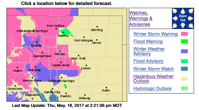
For rest of today (Thursday, May 18)
At lower elevations east of I-25, precipitation will mainly be rain or a mix of rain and snow today with locally up to an inch of rain possible with the heavier showers. Any snow accumulation will be light. The heavier rainfall could cause minor flooding of streets, underpasses, small streams, and low lying areas. River levels are expected to rise as runoff reaches the larger streams.
The heavy wet snow will accumulate on leafed out trees causing limbs to break, and possibly cause scattered power outages.
Freezing temperatures on the plains tonight could injure or kill tender plants.
For tomorrow (Friday, May 19)
At lower elevations, snow is expected to lower to near 5200 feet in the morning, with 2 to 5 inches possible, though 9 to 18 inches isn`t out of the question over the Palmer Divide and closer to the Foothills. Widespread rain across the rest of the plains will continue through the afternoon before tapering off.
Low lying areas may be prone to localized flooding and rivers are expected to swell, do not try to cross flooded roads. This system will bring temperatures that are 20 to 30 degrees below normal for mid- to late-May.
Low temperatures Friday night will likely be at or below freezing.


Leave a Reply