fbpx

Category: Weather & Traffic

  • New Record: 1.96 Million Coloradans Traveling for Holidays

    More Coloradans traveling for holiday season than ever before. 

    DENVER (Dec. 20, 2019) – A record-shattering number of Coloradans – more than 1.96 million – will travel over the course of this holiday season, spanning Saturday, Dec. 21 through Wednesday, Jan. 1. That represents Colorado’s highest year-end travel volume on record since AAA tracking began in 2000, and an increase of more than four percent over 2018. 

    “The end of the year wraps up a decade of historic growth for Colorado, and many Coloradans are taking the news in stride, marking the eighth straight year of successive record-high travel volumes for the year-end holidays,” said AAA Colorado spokesman Skyler McKinley. “We’re lucky to enjoy historically low unemployment and meaningful year-over-year improvements in disposable income and household net worth, and folks are celebrating by hitting the roads and taking to the skies.”


    By the Numbers: 2019 Year-End Travel Forecast

    • Automobiles: The vast majority of Colorado travelers – 1.78 million – will drive to their holiday destinations, joining the ranks of 104.8 million Americans on the road. 
    • Planes: Nearly 120,000 Coloradans will travel by air for the holidays, with 6.97 million Americans taking to the skies in total – the most since 2003. 
    • Trains, Buses and Cruise Ships: Nearly 65,000 Coloradans will travel by other means over the holidays, joining the ranks of nearly 3.81 million Americans in total – a three percent increase over last year.  

    National economic factors influencing the travel forecast include: 

    • Despite some near-term wobbles, the U.S. economy continues to grow at a slightly above-trend pace. GDP growth this year is projected at 2.1 percent. 
    • The national unemployment rate settled at 3.5 percent in November, among the lowest in 50 years. Colorado’s unemployment rate sits well below the national average, at 2.6 percent.
    • At a national level, strong gains in household sector wealth and solid growth in incomes provide a firm foundation for continued strength in consumer spending, which is expected to grow by 4.3 percent. 
    • Gas prices steadily declined in November, paving the way for even cheaper fill-ups for the year-end holidays. AAA expects most motorists to see gas prices drop before the new year, with gas prices in Colorado forecasted to drop a quarter or more.  

    Avoid Road Rage: Plan for Traffic
    For the 104.8 million Americans traveling by automobile, INRIX, in collaboration with AAA, predicts only marginal delays throughout the holiday week – with one notable exception. Motorists should expect the worst delays on Thursday, Dec. 26, with travel times potentially doubled. 

    Traffic delays can add additional stress to an already hectic season. Drivers are encouraged to maintain a cool head and focus on reaching their destination safely. 

    • Do not offend: Never cause another driver to change their speed or direction. That means not forcing another driver to use their brakes or to turn their steering wheel in response to something you have done.
    • Be tolerant and forgiving: The other driver may just be having a really bad day. Never assume that it’s personal.
    • Do not respond: Avoid eye contact, don’t make gestures, maintain space around your vehicle, and contact 9-11 if needed. 

    Prepare for busy airports Dec. 21-23, steep flight prices Dec. 26
    recent analysis  of AAA’s flight booking data revealed that most travelers depart two to four days prior to the Christmas holiday, Dec. 21-23, with the 22nd being the single busiest air travel day of the holiday week. These travelers, on average, pay ticket prices between $593 and $639. Christmas Eve is the best day to travel, with the lowest average price per ticket ($527) and the fewest crowds of the holiday week. Many travelers opt to fly after the Christmas holiday leading up to New Year’s, and they pay a premium to do so. Dec. 26 has the highest average ticket price of the week at $692.

    Hotel prices fluctuate; car rental rates reach 10-year high

    Travelers will need to budget more for car rentals this holiday season. According to AAA’s Leisure Travel Index, the daily average rental rate this Christmas and New Year’s will reach $84, 11 percent more than last year and the highest price in 10 years. AAA Three Diamond hotel prices have increased one percent to $153, while AAA Two Diamond hotels will average $119, two percent less than last year.

    AAA to rescue more than 853,000 motorists
    AAA expects to rescue nearly 853,000 motorists at the roadside over this holiday period. Dead batteries, lockouts and flat tires will be the leading reasons AAA members will experience car trouble. In Colorado, AAA anticipates more than 10,500 drivers will require assistance at the roadside during the travel period. AAA recommends motorists take their vehicle to a trusted repair facility to perform any needed maintenance before heading out. Oil changes, fluid level checks, battery tests and tire inspections go a long way toward reducing the chances of a breakdown. Find a good mechanic at AAA.com/Repair

    About the Forecast
    AAA’s projections are based on economic forecasting and research by IHS Markit, a London-based business information provider. For the purposes of this forecast, the year-end holiday travel period is defined as the 12-day period from Saturday, Dec. 21 to Wednesday, Jan. 1.

    In cooperation with AAA, IHS Markit developed a unique methodology to forecast actual domestic travel volumes, using macroeconomic drivers such as employment; output; household net worth; asset prices including stock indices; interest rates; housing market indicators and variables related to travel and tourism, including prices of gasoline, airline travel and hotel stays. 

    About INRIX: 
    INRIX is the global leader in connected car services and transportation analytics. Leveraging big data and the cloud, INRIX delivers comprehensive services and solutions to help move people, cities and businesses forward. Our partners are automakers, governments, mobile operators, developers, advertisers, as well as enterprises large and small. 

    About AAA Colorado
    More than 695,000 members strong, AAA Colorado is the state’s greatest advocate for the safety and security of all travelers. As North America’s largest motoring and leisure travel organization, AAA provides more than 60 million members with travel, insurance, financial, and automotive-related services — as well as member-exclusive savings. A not-for-profit organization since its founding in 1923, AAA Colorado has been recognized as the number one Colorado company its size for its advocacy, community engagement, and corporate social responsibility efforts – and is a proud member of Points of Light’s “The Civic 50 Colorado,” recognizing the 50 most community-minded companies in the state. For more information, visit AAA.com.

    SPREAD THE NEWS

    COMMENT, Like, Follow & SHARE @I70Scout

    CURRENT EDITION

    WEATHER & TRAFFIC    PUZZLES    RECENT NEWS    ADVERTISE WITH US


  • E-470 Weekend Traffic Advisory

    E-470 Weekend Traffic Advisory

    Ramp B Full Closure, East Colfax Avenue Lane Closure

    December 20 – 23

     Aurora, CO — Starting at 7 p.m. on Friday, December 20, East Colfax Avenue will be reduced to one lane beneath the E-470 bridge as crews begin erecting girders for the bridge. Schedule depending, both lanes should be reopened to the travelling public by 9 a.m. Saturday, December 21. Minor delays can be expected, and as a reminder for motorists, please drive at the posted speed limits in the construction zone.

     From 9 p.m. Saturday, December 21 to 9 a.m. Sunday, December 22, the southbound on-ramp from I-70 to E-470 will be closed as girders are set for the E-470 bridge expansion. Traffic will be detoured through Gun Club Road and uniformed traffic control will be in place to keep traffic moving. Expect delays when travelling through this detour.

     In addition, from 7 p.m. Sunday, December 22, to 5 a.m. Monday, December 23, I-70 will be reduced to one lane in both directions beneath the E-470 bridge as crews restripe the lanes. The travelling public can expect reduced speeds through this area.

     Note that all activities are weather dependent.

     E-470 is the 75-mph toll road running along the eastern perimeter of the Denver metropolitan area. E-470 is a user-financed roadway, receiving no local, state or federal funds for financing, construction, operations or maintenance. E-470 is a political sub-division of the state governed by the E-470 Public Highway Authority Board composed of eight local governments including Adams, Arapahoe and Douglas counties, and the municipalities of Aurora, Brighton, Commerce City, Parker and Thornton. E-470 also operates ExpressToll, the all-electronic toll collection system available on E-470, Northwest Parkway, and Colorado’s Express Lanes.


    SPREAD THE NEWS

    COMMENT, Like, Follow & SHARE @I70Scout

    CURRENT EDITION

    WEATHER & TRAFFIC    PUZZLES    RECENT NEWS    ADVERTISE WITH US
     

  • The 2019 US tornado season included an ‘extraordinary’ occurrence

    The 2019 US tornado season included an ‘extraordinary’ occurrence

    Updated Dec. 13, 2019 10:33 AM

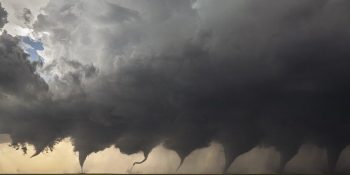
    A pair of unforgettable tornadoes bookended the 2019 U.S. tornado season, which is effectively over; the National Oceanic and Atmospheric Administration (NOAA) has no reports of tornadoes so far in December. The U.S. tornado season typically runs from March through November or sometimes into early December, although tornadoes can occur at any time.  

    The year’s deadliest event was an EF4 tornado that killed 23 people in Lee County, Alabama, in early March. Tornadoes and their destruction killed a total of 38 people in the U.S. this year. 

    Last year, the U.S. set a record low for the number of fatalities with just 10 people killed, the lowest number since tornado fatality record-keeping began in 1875. The previous record low total was 12 in 1910. Tornadoes cause an average of 80 U.S. fatalities annually.

    However, one of the costliest tornado outbreaks in Texas history, amazingly, resulted in no deaths when it struck north Dallas on October 20 and 21. AccuWeather estimates the total damage and economic loss from that severe outbreak of 10 tornadoes – including an EF3 – will approach $4 billion. 

    The tornado that struck Jefferson City, Missouri, was one of 556 nationally that occurred in May, an unofficial record for the month. (Twitter photo/Jefferson City Mayor Carrie Tergin)

    “The tornado outbreak this past October was extraordinary in the sense that, thankfully, nobody was killed,” said AccuWeather Founder and CEO Dr. Joel N. Myers. “Nobody – not one person! That’s the story – the amazing progress that has been made in weather forecasting accuracy over the last 50 or more years and our ability to get life-saving warnings to people in advance so they can take action and get out of harm’s way certainly paid off in this case.”

    In between the events in Alabama and Texas, 556 tornadoes occurred nationally in May, unofficially breaking the record for the month of 542 set in 2003, though the monthly total has yet to be confirmed. The 25-year average for May is 269 tornadoes. 

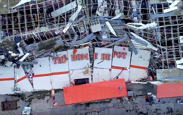
    Aerial image shot by a drone shows a Home Depot store in Dallas, Texas, that was obliterated after a destructive nocturnal tornado ripped through the area on Sunday, October 20, 2019. (SevereStudios / John Humphress)

    AccuWeather’s 2019 forecast released in February accurately pinpointed the areas to be hit hardest this year, with a higher frequency of severe weather risks in the traditional Tornado Alley — notably Oklahoma, Kansas and parts of Texas – which is more than they had experienced on average the previous three years. 

    “People were starting to question whether Tornado Alley should be shifted farther east, but our forecast accurately called for more events in the traditional area this year,” said AccuWeather Lead Long-Range Meteorologist Paul Pastelok. 

    Texas, with 188 tornadoes, has experienced the most of any state in the U.S., according to preliminary, unconfirmed data from NOAA. Kansas is second with 127, while Oklahoma and Mississippi are tied for third with 98. 

    “We are trying to prepare people in advance where disruptive weather can occur more frequently throughout the season and impact their safety, work or everyday plans,” Pastelok said. “We work to save as many lives as possible and to give people, companies, those in emergency services and others as much advance notice as possible to prepare and to take action.”  

    NOAA’s preliminary reports show there have been 1,603 tornadoes in 2019, but that total is not a confirmed final number. The inflation-adjusted annual tornado running total – which attempts to remove overcount by multiplying the preliminary total by 0.85 – is 1,363, according to NOAA. 

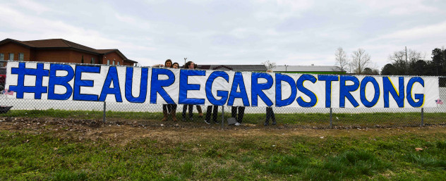
    Students from Beauregard High School in Beauregard, Ala., post a sign in support of the victims of Sunday’s deadly tornados on the school’s fence Monday, March 4, 2019. (AP Photo/Julie Bennett)

    There were 1,169 tornadoes in 2018, and the 25-year average is 1,199 tornadoes a year, according to NOAA’s Storm Prediction Center. AccuWeather’s forecast in February for 2019 estimated an increase of roughly 20 percent over the 25-year average.

    Tornado-related fatalities have been trending downward despite more people living in tornado-prone areas. The reasons for this trend include advances in weather science and technology, the increasing accuracy and speed of processing warnings and the effectiveness of warning methods such as through mobile apps, as well as better cooperation between government weather services and the American weather industry that includes AccuWeather.

    AccuWeather is a proud and early partner of NOAA’s WeatherReady Nation resiliency program, which helps to continue this trend, and the company is proud to get these lifesaving warnings out to the public rapidly and accurately through its apps and website. 


    SPREAD THE NEWS

    COMMENT, Like, Follow & SHARE @I70Scout

    CURRENT EDITION

    WEATHER & TRAFFIC    PUZZLES    RECENT NEWS    ADVERTISE WITH US


  • The 2019 California wildfires caused less damage than the last two devastating seasons

    The 2019 California wildfires caused less damage than the last two devastating seasons

    AccuWeather predicted earlier this year that the California wildfire season would be extended into December and that the total damage and economic loss caused by the state’s wildfires would be $80 billion, a pair of estimates that accurately reflect what occurred during the 2019 California wildfire season. 

    There were a total of 253,354 acres burned in California in 2019 and the wildfires that scorched the most land area were Kincade (77,758 acres), Walker (54,612 acres), Tucker (14,217 acres) and Maria (9,999 acres), according to the California Department of Forestry and Fire Protection. October was the most active wildfire month this year with 119,814 acres burned, followed by 83,908 acres consumed in September, 21,454 acres burned in July and 16,430 acres charred in August. There were also documented wildfires in every month except February, March and December. 

    For comparison, wildfires burned 1.8 million acres in California last year and 1.3 million acres in 2017.

    “There were much fewer acres burned this year than last,” said AccuWeather Founder and CEO Dr. Joel N. Myers. “But there were more power outages this year than last, which increased costs for businesses and individuals. We predicted power outages – both proactive and reactive – would be more of a factor and they were, resulting in a significant cost per customer during the duration of the blackouts.”

    California’s three big power companies – Pacific Gas & Electric (PG&E), Southern California Edison and San Diego Gas & Electric – engaged in Public Safety Power Shut-offs (PSPS) as part of their plans to prevent wildfires sparked by a transmission line. PG&E’s four mass blackouts in October left hundreds of thousands of homes and business without power, with an Oct. 26 blackout cutting power to as many as three million people, according to The New York Times

    The Insurance Journal estimated that insured losses from California wildfires were $25.4 billion through Oct. 29. It notes, however, “Damage estimates can vary because some only contain insured losses, while others take in everything that was destroyed. After disasters, many people will pay for repairs out of their own pocket, which often leads to under counting.”

    Myers agrees there’s a likelihood of a substantial under-estimation of the damages. “The insurance costs through October 29 were $25.4 billion and there were additional fires subsequently damaging roughly 17,000 acres,” he said. “So the total of insured losses is now probably closer to $40 billion and insured losses usually represent only about half of the total loss, suggesting our $80 billion estimate is accurate.”


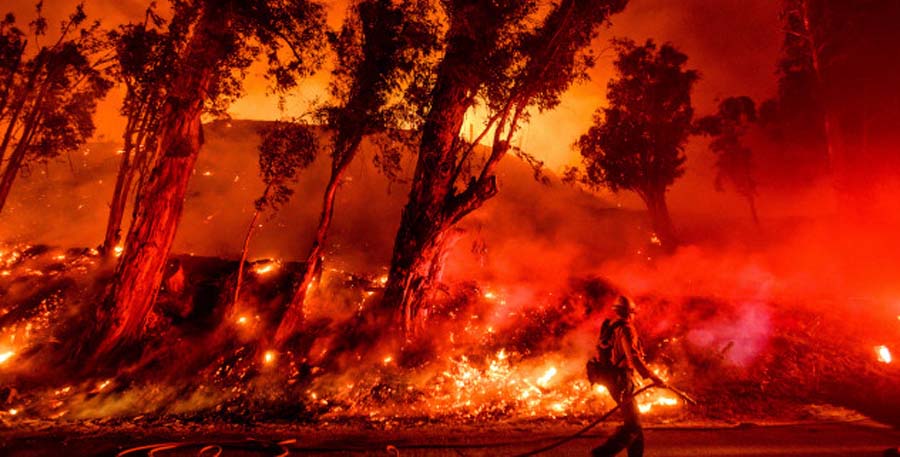
    Flames from a backfire consume a hillside as firefighters battle the Maria Fire in Santa Paula, Calif., on Friday, Nov. 1, 2019. According to Ventura County Fire Department, the blaze has scorched more than 8,000 acres and destroyed at least two structures. (AP Photo/Noah Berger)


    The 2019 California wildfire season follows two of the largest, most destructive and deadliest seasons in the state’s history. AccuWeather estimates the total damage and economic loss caused by wildfires cost California $400 billion in 2018 and $85 billion in 2017. 

    The “wet season,” which typically begins in California in October and runs into March, was delayed this year, with many cities receiving no measurable precipitation until late November. In Fresno, rain arrived on Nov. 20, making it the third-latest start to the wet season on record, behind Dec. 11, 1995 and Nov. 30, 1923. 

    “Typically, we have seen storms come down during the middle or latter part of October and at least bring some precipitation,” said AccuWeather senior meteorologist Dan Kottlowski. “[To go] through the middle of November with no rainfall is highly unusual…. But that was predicted – we thought that would be the case, so we weren’t surprised about that.” 

    AccuWeather’s estimate includes damage to homes and businesses as well as their contents and cars, job and wage losses, school closures and the costs of power outages to businesses and individuals. It also accounts for economic losses because of highway closures, evacuations and increased insurance premiums throughout the state, firefighting costs, airport closures, flight cancellations and delays and the current and long-term residual health effects on those impacted by smoke and dirty air. 

    Download the free AccuWeather app to track the temperature for your area. Keep checking back for updates on AccuWeather.com and stay tuned to the AccuWeather Network on DIRECTV, Frontier and Verizon Fios.


    SPREAD THE NEWS

    COMMENT, Like, Follow & SHARE @I70Scout

    CURRENT EDITION

    WEATHER & TRAFFIC    PUZZLES    RECENT NEWS    ADVERTISE WITH US
     

  • Massive storm looming over Pacific to wreak havoc up and down West Coast

    Massive storm looming over Pacific to wreak havoc up and down West Coast

    By Kyle Elliott, AccuWeather meteorologist

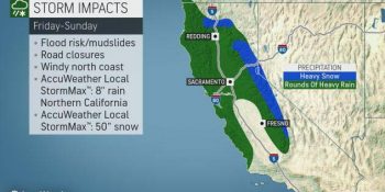
    After one storm system walloped Southern California and Arizona with heavy rain and high-country snow this week, a much larger storm is set to slam Central and Northern California with a wide array of impacts from Friday into Saturday.

    Although the center of the storm system will move ashore in Oregon later Saturday into Saturday night, the worst of the impacts will occur farther to the south.

    Heavy rain and gusty winds will target coastal areas from San Francisco northward into southern Oregon spanning Friday into Saturday, as well as the Central Valley’s I-5 corridor from Sacramento to Redding.


    The foothills of the Sierra Nevada will also be hit hard with flooding downpours during this time.

    A general 1-2 inches of rain is forecast in the lowest elevations of the I-5 corridor and San Francisco Bay area, while 2-4 inches is more likely in coastal areas of Northern California.

    It is in the coastal ranges and foothills of the Sierra, however, that rainfall totals of 3-6 inches will occur. An AccuWeather Local StormMax™ of 8 inches is anticipated in these regions.

    Because California is no longer suffering from drought and has actually been abnormally wet over the past one to two weeks, the heavy rainfall will significantly heighten the risk for flooding and mudslides, especially in burn-scar areas from this year’s wildfires.

    Significant travel delays and road closures are also likely, especially in areas where stream and river flooding occurs or where mudslides cover roadways or cause them to collapse.

    “In addition to the extreme amounts of rain, falling snow levels will allow snow to accumulate across the higher terrain of the Sierra Nevada, which will act as a boon for local ski resorts,” AccuWeather Meteorologist Brandon Buckingham said.

    Snow levels will likely fall below 5,000 feet in the Cascades and northern Rockies on Saturday and as low as 5,500 feet in the Sierra Nevada.

    Spanning Friday to Saturday night, AccuWeather meteorologists expect at least 1-2 feet of snow to bury Donner Pass along I-80 in Northern California with 2-4 feet in the highest elevations.

    An AccuWeather Local StormMax™ of 50 inches of snow is expected in the highest terrain of Northern California.

    Motorists traveling through the Sierra Nevada should be aware of chain requirements and be prepared with an emergency survival kit in case their vehicle breaks down or stalls.

    “While major snowfall accumulations farther north in the Washington and Oregon cascades are not expected from this storm system, any snow will be beneficial since these areas are suffering from abnormally dry conditions,” Buckingham added.

    In addition to the copious amounts of rain and snow slated for the end of the week and start of the weekend, gusty winds will buffet the northern half of California and southern part of Oregon.

    Wind gusts of 40-50 mph will threaten to cause sporadic power outages and may help weaken loose topsoil inundated by too much water, further enhancing the risk of mudslides. Blizzard conditions may occur at times in the Sierra Nevada.

    Drier conditions should gradually return from Sunday into Monday as the storm system pushes into the Rockies and Plains.

    Looking ahead into next week, storm-weary residents of California should finally catch a break from the onslaught as the storm track shifts farther north into the Pacific Northwest.


    SPREAD THE NEWS

    COMMENT, Like, Follow & SHARE @I70Scout

    CURRENT EDITION

    WEATHER & TRAFFIC    PUZZLES    RECENT NEWS    ADVERTISE WITH US
     

  • Powerful storm to slam West Coast with feet of snow, flooding rain late this week

    Powerful storm to slam West Coast with feet of snow, flooding rain late this week

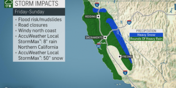
    After one storm system wallops Southern California and Arizona with heavy rain and high-country snow through Wednesday night, a much larger storm is set to slam Central and Northern California with a wide array of impacts from Friday into Saturday.

    Although the center of the storm system will move ashore in Oregon later Saturday into Saturday night, the worst of the impacts will occur farther to the south.

    Heavy rain and gusty winds will target coastal areas from San Francisco northward into southern Oregon spanning Friday into Saturday, as well as the Central Valley’s I-5 corridor from Sacramento to Redding.

    The foothills of the Sierra Nevada will also be hit hard with flooding downpours during this time.

    A general 1-2 inches of rain is forecast in the lowest elevations of the I-5 corridor and San Francisco Bay area, while 2-4 inches is more likely in coastal areas of Northern California.

    It is in the coastal ranges and foothills of the Sierra, however, that rainfall totals of 3-6 inches will occur. An AccuWeather Local StormMax™ of 8 inches is anticipated in these regions.

    Because California is no longer suffering from drought and has actually been abnormally wet over the past one to two weeks, the heavy rainfall will significantly heighten the risk for flooding and mudslides, especially in burn-scar areas from this year’s wildfires.

    Significant travel delays and road closures are also likely, especially in areas where stream and river flooding occurs or where mudslides cover roadways or cause them to collapse.

    “In addition to the extreme amounts of rain, falling snow levels will allow snow to accumulate across the higher terrain of the Sierra Nevada, which will act as a boon for local ski resorts,” AccuWeather Meteorologist Brandon Buckingham said.

    Snow levels will likely fall below 5,000 feet in the Cascades and northern Rockies on Saturday and as low as 5,500 feet in the Sierra Nevada.

    Spanning Friday to Saturday night, AccuWeather meteorologists expect at least 1-2 feet of snow to bury Donner Pass along I-80 in Northern California with 2-4 feet in the highest elevations.

    An AccuWeather Local StormMax™ of 50 inches of snow is expected in the highest terrain of Northern California.

    Motorists traveling through the Sierra Nevada should be aware of chain requirements and be prepared with an emergency survival kit in case their vehicle breaks down or stalls.

    “While major snowfall accumulations farther north in the Washington and Oregon cascades are not expected from this storm system, any snow will be beneficial since these areas are suffering from abnormally dry conditions,” Buckingham added.

    In addition to the copious amounts of rain and snow slated for the end of the week and start of the weekend, gusty winds will buffet the northern half of California and southern part of Oregon.

    Wind gusts of 40-50 mph will threaten to cause sporadic power outages and may help weaken loose topsoil inundated by too much water, further enhancing the risk of mudslides. Blizzard conditions may occur at times in the Sierra Nevada.

    Drier conditions should gradually return from Sunday into Monday as the storm system pushes into the Rockies and Plains.

    Looking ahead into next week, storm-weary residents of California should finally catch a break from the onslaught as the storm track shifts farther north into the Pacific Northwest.


    SPREAD THE NEWS

    COMMENT, Like, Follow & SHARE @I70Scout

    CURRENT EDITION

    WEATHER & TRAFFIC    PUZZLES    RECENT NEWS    ADVERTISE WITH US
     

  • Atmospheric river to soak Southern California, Southwest

    Atmospheric river to soak Southern California, Southwest

    Following a delayed start to the wet season in fire-ravaged California, the switch has been turned on as a series of storms continues to douse the Golden State. Soon after a storm over Northern and Central California winds down, a new plume of moisture, or an atmospheric river, will unleash heavy rain and high country snow over Southern California to the interior Southwest at midweek.

    The storm is not expected to unleash the equivalent of the late-November blast of rain and snow; however, it is likely to cause travel disruptions in many locations and perhaps more serious problems in others.

    Snow levels are forecast to be rather high in Southern California, so motorists should not have to contend with winter conditions over Tejon and Cajon passes this time around.

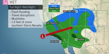
    Snowfall with the storm from Tuesday night to Wednesday night will generally be limited to elevations above 6,500 feet over much of Southern California and Arizona but can dip to 5,500 feet over the southern part of the Sierra Nevada, where 1-2 feet of snow is in store.

    High snow levels can present a problem following a heavy snowfall, according to AccuWeather Meteorologist Randy Adkins.

    “The higher snow levels throughout the region will mean that rain will eat into some of the snowfall over the intermediate elevations in Southern California and Arizona in particular,” Adkins said.

    The combination of rain, rising temperatures and melting snow can lead to flooding along some the small streams and short-run rivers flowing out of the mountains.

    A general rainfall of 1-2 inches is forecast to fall in about 24 hours over coastal Southern California with 0.50 of an inch to 1 inch over the deserts.

    Heavier rainfall is expected over the mountains. An AccuWeather Local StormMax™ of 4 inches can occur in the south- and west-facing slopes of the San Gabriel Mountains.

    This is enough rain to cause localized flash flooding in desert and urban areas.

    Motorists should expect delays due to drenching rain, excess water on the roads and poor visibility for the Wednesday morning rush hour in the Los Angeles and San Diego areas.

    The bulk of the rain will fall on Las Vegas during Wednesday afternoon and evening with the wettest part of the storm due to be Wednesday night around Phoenix.

    AccuWeather meteorologists warn that you should never attempt to drive through flooded areas as the water may be much deeper than it appears. A foot of flowing water can cause lightweight vehicles to lose traction and can swiftly carry them downstream into deeper water. Flowing water can also disguise a roadway that has been washed away.

    Tragedy struck in Arizona over the Thanksgiving holiday as a truck with young children as passengers was swept away while attempting to cross a stream.

    Since the last rainstorm was only a few days earlier, some of the hillsides may quickly become unstable with a fresh dose of drenching rain. As a result, the potential for mudslides and other debris flows may be higher with this storm, compared to that of last week. This is especially the case for burn scar locations, but the threat will not be limited to fire-charred areas.

    Meanwhile, the system moving through is potent enough to produce a few thunderstorms, some of which may be capable of spawning small hail and gusty winds.

    The region will get a break from storms during the latter part of this week. However, a new storm forecast to roll ashore in Northern California and the Northwest is likely to bring showers this weekend.

    SPREAD THE NEWS

    COMMENT, Like, Follow & SHARE @I70Scout

    CURRENT EDITION

    WEATHER & TRAFFIC    PUZZLES    RECENT NEWS    ADVERTISE WITH US
     

  • ACCUWEATHER METEOROLOGISTS PROVIDE UPDATE ON RAIN AND SNOW HEADED TOWARD WEST COAST

    ACCUWEATHER METEOROLOGISTS PROVIDE UPDATE ON RAIN AND SNOW HEADED TOWARD WEST COAST

    Soon after the ‘bomb cyclone’ pushes east of the Rockies, a new storm will approach the West Coast of the United States this weekend to set the stage for more rounds of heavy rain and mountain snow in California.

    The storm will hinder return trips from Thanksgiving vacation as well as the resumption of daily commutes next week.

    The weather setup will make the ignition of wildfires unlikely and may even put an end to the risk through the rest of the year. However, enough rain can fall to unleash urban flooding and lead to debris flows in recent burn scar locations, including the Kincade Fire that burned over 77,000 acres in Sonoma County, California, earlier this autumn.

    While the heavy mountain snow anticipated will be a further boon for ski interests, snow and slippery driving conditions are likely at Donner Pass along Interstate 80 from Saturday afternoon into Monday night.

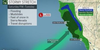
    A storm at the jet stream level of the atmosphere is forecast to hover just off the California coast later this weekend to early next week. The configuration will create a plume of tropical moisture from the Pacific Ocean to Northern California beginning late Saturday night.

    “This persistent plume, sometimes referred to as an ‘atmospheric river,’ will bring copious amounts of rain to coastal and low elevations and a great deal of snow to the Sierra Nevada of Northern California,” said AccuWeather Senior Meteorologist Brett Anderson.

    About 3-6 inches of rain can fall over the lower elevations of Northern California during the early to middle part of next week. However, an AccuWeather Local StormMax™ of 10 inches can occur on the southwest-facing slopes of the Coast Ranges and hills of the Sierra Nevada.

    Meanwhile, over in the high country, 3-6 feet of snow can fall from later this weekend to early next week.

    “It is possible that Southern California catches an episode or two of heavy rain and mountain snow as well,” Anderson said.


    SPREAD THE NEWS

    COMMENT, Like, Follow & SHARE @I70Scout

    CURRENT EDITION

    WEATHER & TRAFFIC    PUZZLES    RECENT NEWS    ADVERTISE WITH US
     

  • Steamboat Resort, Gondola Shut Down.

    Steamboat Resort, Gondola Shut Down.

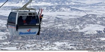
    STEAMBOAT SPRINGS, Colo. (AP) _ The new gondola at Steamboat Resort in northern Colorado has been shut down because of a mechanical malfunction.

    The Steamboat Pilot & Today reports that with a busy holiday week ahead, crews were working to repair the gondola, but a timeline for its reopening was not immediately known. The resort has opened the Thunderhead Express for guests to access the open terrain.

    Steamboat Ski & Resort Corp. digital communications manager Maren Franciosi says the new gondola fully opened to the public last Saturday but then was shut down at about 4:45 p.m. Sunday

    The malfunction occurred on the drive line to the gear box in the upper terminal.

    There were no guests on the gondola at the time it stopped working.

    SPREAD THE NEWS

    COMMENT, Like, Follow & SHARE @I70Scout

    CURRENT EDITION

    WEATHER & TRAFFIC    PUZZLES    RECENT NEWS    ADVERTISE WITH US
     

  • ‘Perfect Storm’ for Holiday Travelers – Stay off the roads if you can. Plan for long delays if you can’t. 

    ‘Perfect Storm’ for Holiday Travelers – Stay off the roads if you can. Plan for long delays if you can’t. 

    DENVER (Nov. 25, 2019) – In many ways, it’s the perfect storm: Severe winter weather will bring a foot or more of snow to much of Colorado through Tuesday night, at the same time that nearly a million Thanksgiving travelers will begin to mix with folks commuting to and from work. 

    The National Weather Service warns that travel may become “impossible” across the I-25 urban corridor and north of I-70 across the Eastern Plains. 

    AAA urges Coloradans to avoid driving until the storm has passed. If you must drive, slow down, be cautious, and prepare for worst-case conditions. Before heading out, visit CoTrip.org for the latest road conditions.  

    Effects on Thanksgiving Travel
    Thanksgiving travelers headed to or through Denver International Airport through Tuesday evening should expect delays and cancellations. Check with your airline for travel advisories and potential itinerary changes. 

    Motorists should adjust their trips to avoid driving until the storm has passed. If you can’t wait out the entire storm, Thanksgiving travelers should at least stay off the roads during the Tuesday morning and evening commutes, when traffic will be at its worst. 

    Coloradans traveling Wednesday should plan for lengthy delays, as folks with earlier travel plans instead join them on the roads and at the airport on what was already the single busiest travel day of the period. 

    Other than anticipating a transfer of travel volume from Monday and Tuesday to Wednesday, AAA Colorado is not adjusting its holiday travel forecast at this time.

    Emergency Roadside Assistance
    AAA Colorado will be fully staffed with essential personnel, and our emergency roadside assistance fleet will be out in full force. High call volume, treacherous conditions, heavy traffic, and road closures will sharply increase response times. Moreover, emergency assistance vehicles are only able to rescue stranded motorists on open, maintained roads. If a roadway is closed by an authority, AAA vehicles cannot legally and will not traverse it to provide emergency roadside assistance.  AAA Colorado will be working in tandem with local governments and emergency personnel throughout the storm. Stranded motorists should follow local emergency guidance.  

    How to: Stay Safe
    Hazardous storms and inclement weather are a factor in half a million crashes and more than 2,000 road deaths every winter, according to research from the AAA Foundation for Traffic Safety. 

    If you can avoid driving, avoid driving – especially when it’s busy.


    • Stay in: If you don’t absolutely have to drive in wintry conditions, don’t drive. Appointments that can be re-scheduled for later in the day, should be.
    • Stagger start:  It almost goes without saying: The easiest way to both avoid traffic and creating traffic is to stay clear of the roads when everybody else is on them. If your employer offers staggered start times or work-from-home opportunities, look into those to avoid the morning rush. 
    • Early or later: A good rule of thumb is to plan to arrive to work much, much earlier or much, much later than you normally would. 

    Before You Head Out


    • Time: The only way to drive safely in snow and ice is to drive slowly. Budget extra time for your morning commute. Even if traffic jams are minimal, it will take you longer to get to work because you will need to move more slowly – so avoid creating extra stress by budgeting at least twice the commute time.
    • Parking brake: Avoid parking with your parking brake before and in cold, rainy or snowy weather. It can get frozen and may not disengage. For automatic transmissions, simply shift into park. For manual transmissions, shift into first gear when parking facing downhill or front-in and reverse when parking  facing uphill or back-in.
    • Wipers: Your wiper blades have been warning you for months that they’re not ready for winter by streaking, screeching, or bouncing around on the glass. New wiper blades are among the cheapest pieces of safety-critical equipment you can purchase for your vehicle. They take only a couple of minutes to swap out, and most auto parts stores will do that for you immediately after purchase. Make sure you’ve got wiper fluid that won’t freeze in winter, and plenty of it. After all, if you can’t see clearly, you can’t drive safely. 
    • Snow-covered car: If your car was parked outside during the storm, completely clear off all snow and ice before heading out. That means the windshield, your windshield wiper nozzles, the windows, the hood, the roof, the trunk, the mirrors and even the running boards. Everything. Why? When you start moving, that snow and ice will start moving with you. Once dislodged, it can seriously impair your ability to see – and even fly off and endanger other motorists . Why take the risk?
       
    • Gas: Keep your gas tank at least half full to prevent a gas line freeze-up and potential long-term issues with your fuel pump. You’ll be glad you have the extra gas in an emergency situation, to boot. 
    • Tires: If your low tire pressure warning light came on, fill up your tires to the level recommended by your manufacturer (in your owner’s manual or on your door jamb). This is the recommended level specifically for cold weather, so you’ll want to fill up before heading out and after your car has been sitting for a while. If you can’t fill your tires at home, stop to fill them off before your commute. This light comes on specifically to warn you that you might not have enough pressure for the road conditions, so don’t ignore it. If, once filled, your tires fail the quarter test for tread, it’s time for new tires. Avoid driving, especially in wintry conditions, until you have them.


    On the Road


    • Gradual start: You have the greatest traction just before the wheels spin. Gentle pressure on the accelerator pedal when starting from a stop is the best method for retaining traction and avoiding skids. If your wheels start to spin, let up on the accelerator until traction returns. Do not use cruise control. 
    • Go slow: No matter what type of vehicle you have or what type of tires you’re riding, it’s plainly unsafe to drive as quickly as you would in dry conditions. Normal following distances for dry pavement (three to four seconds) should be increased to eight to 10 seconds. Give yourself even more space (12-15 seconds or more) if you are new to winter driving.
    • Stay in your lane: On a four-lane highway, stay in the lane that has been cleared most recently. Avoid changing lanes because of potential control loss when driving over built-up snow between lanes. 
    • Steering: At speeds above 25mph, steering is the preferred way to avoid a crash – as less distance is required to steer around an object than to brake to a stop. In slick conditions, sudden braking can lead to a loss of control.
       
    • Know your environment: Shaded spots, bridges, overpasses, and intersections are where you’ll most likely find the slipperiest ice. Even if your commute was dry and manageable in parts, it is likely you will encounter ice along the way – so focus your attention as far ahead as possible and slow down as much as possible before driving over likely ice patches. 
    • Manage a skid: If you lose traction and begin to skid, stay calm to regain control of your vehicle. Always steer in the direction you want the front of the vehicle to go. Do NOT slam on the brakes, which will make it harder to regain control. 
    • Put the phone away: Put your phone in the glovebox, or, if used for navigation, in a secure mount. Do not read or send text messages, place a call, check social media, browse the internet, or adjust your GPS directions while moving. Distracted driving is always dangerous driving, and doubly so when challenging conditions demand your absolute attention at all times. 


    About AAA Colorado
    More than 695,000 members strong, AAA Colorado is the state’s greatest advocate for the safety and security of all travelers. As North America’s largest motoring and leisure travel organization, AAA provides more than 60 million members with travel, insurance, financial, and automotive-related services — as well as member-exclusive savings. A not-for-profit organization since its founding in 1923, AAA Colorado has been recognized as the number one Colorado company its size for its advocacy, community engagement, and corporate social responsibility efforts – and is a proud member of Points of Light’s “The Civic 50 Colorado,” recognizing the 50 most community-minded companies in the state. For more information, visit AAA.com.

    SPREAD THE NEWS

    COMMENT, Like, Follow & SHARE @I70Scout

    CURRENT EDITION

    WEATHER & TRAFFIC    PUZZLES    RECENT NEWS    ADVERTISE WITH US